
by Bill Morris for VCGI Oct 28 2014
A practical guide to web-based version control and collaboration for the GIS-inclined
Why use github? What's wrong with ArcSDE/ PostGIS/ Thatendlessbunchoffoldersonmydesktop?
Free
Backed-up
Versioned
Collaborative

That's it!
(not really; we have some work to do. But is is that easy to get started.)
For good measure, install the github app (aka CodeBeGone)
(for mac & for windows)
Fork this repository
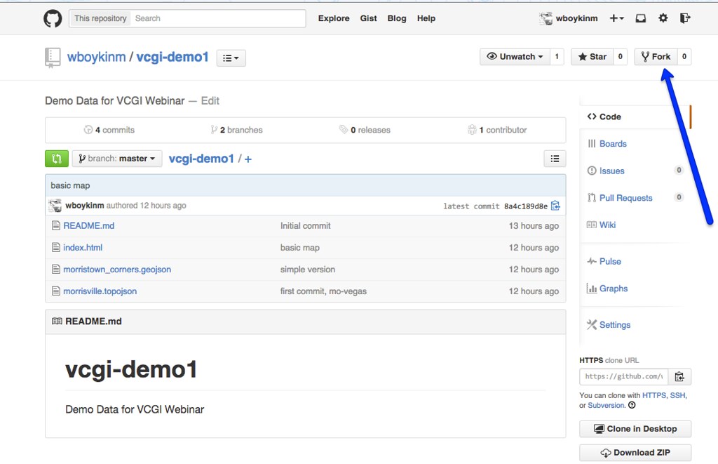
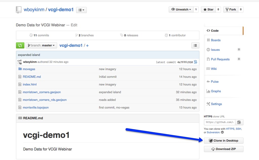
Sync it to your computer
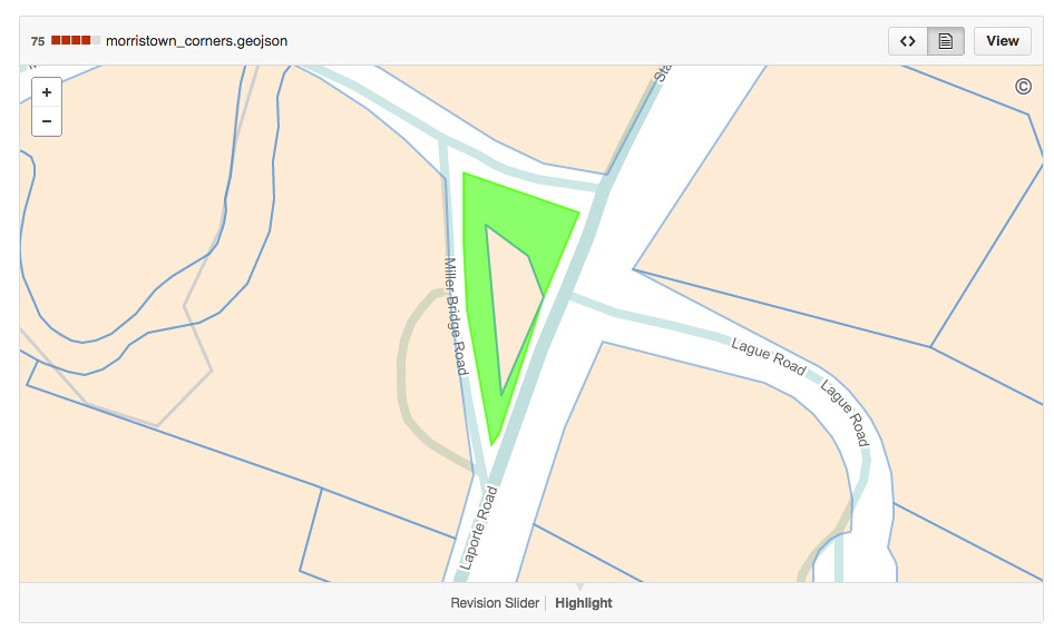
Look at a dataset (try this example)
To add new data, convert from your fave format first. tools:
geojson and topojson - shapefiles for the web
A few options:
Tiny data (<8MB): Use geojson.io
Bigger data (8MB - 100MB): Edit locally and sync using the github app
Big data (>100MB): We're not really there yet.
github pages - web apps, hosted for free
That repository you forked comes with a simple viewing app
updates to data are immediately available in the app
(this can get a lot more complicated, but it doesn't need to)
What's missing?
Geoprocessing (though we're getting there)
Scale - this one might require a paradigm shift
Buy-in
Get in touch with any questions: bill@faraday.io @vtcraghead